Reasons for Renumbering | Events
of 1963-64
Renumbering Explained | Summary
of Affected US Routes
Conclusion | Links
|
1964 Highway Renumbering
Reasons for Renumbering | Events
of 1963-64 |
 On July 1, 1964, a
major change in the numbering of California highways took effect that resulted in the
disappearance of most US highways and major changes in highway numbers throughout the
state. The renumbering was the result of legislation passed September 20, 1963 (Senate
Bill 64, Collier) that streamlined the highway numbering system. By 1963 highway numbering
in the state had become very complicated, resulting in confusion to motorists. This
situation was further exacerbated by the appearance of the new signed Interstate highways in 1960
with federally designated numbers that duplicated existing numbers on US and state sign
routes. In response to this situation, the legislation did four things: 1.) It made the
legislative route numbers the same as the sign route numbers; 2.) It implemented a policy
of "one number equals one highway;" 3.) It eliminated any duplicated
numbers; and 4.) It replaced the system of stations based on legislative route
numbers with post miles.
On July 1, 1964, a
major change in the numbering of California highways took effect that resulted in the
disappearance of most US highways and major changes in highway numbers throughout the
state. The renumbering was the result of legislation passed September 20, 1963 (Senate
Bill 64, Collier) that streamlined the highway numbering system. By 1963 highway numbering
in the state had become very complicated, resulting in confusion to motorists. This
situation was further exacerbated by the appearance of the new signed Interstate highways in 1960
with federally designated numbers that duplicated existing numbers on US and state sign
routes. In response to this situation, the legislation did four things: 1.) It made the
legislative route numbers the same as the sign route numbers; 2.) It implemented a policy
of "one number equals one highway;" 3.) It eliminated any duplicated
numbers; and 4.) It replaced the system of stations based on legislative route
numbers with post miles.
Prior to 1963, there were two independent and almost unrelated systems of numbering California highways that eventually caused a great deal of confusion. All state highways were assigned a legislative route number, a practice predating signed highways that started with the assignment of Legislative Route (LR) 11 to what is now US 50. As time went on, the numbering scheme became more complicated as routes were extended and as succeeding legislatures assigned more numbers. The US highways were the first signed routes in to appear in California, beginning in 1928 and signified the start of complications in route numbering. Since the US highway numbers were assigned by the Federal Government based on the recommendation of the American Association of Highway Officials (AASHO), none of the signed numbers matched the legislative number. For example, LR 1 and LR 2 became US 101 and LR 58 became US 466.
In 1934 the disparity between legislative route numbers and signed route numbers became even greater with the introduction of the State Sign Routes, a system designed to complement the US numbered highways. Now it was both possible and common for a legislative route to have more than one sign number route and vice-versa. For example, LR 43 was State Sign Route (SSR) 55, SSR 18 while US 91 and US 466 covered parts of both LR 31 and LR 58. This confusion is especially evident in California Highways and Public Works magazines where legislative and sign route numbers were used interchangeably to refer to highway projects under construction. While this surely created many administrative nightmares and headaches, the effect on motorists appears to have been minimal.
As California's highway system grew, many signed route numbers started to overlap and created increasing confusion for travelers. The 1964 article in CHPW about the new route numberings discusses the situation:
"In the past, portions of many California highways have been marked with the shields of multiple routes because those particular stretches were incorporated into a combination of two or more state and federal highways. This practice [. . .] complicated travel for unwary drivers unacquainted with the procedure.
A couple of notorious examples of this multiple signing include the combination of US 60, US 70, and US 99 and also US 66, US 91, US 395, and SSR 18. The latter, in particular is confusing. While US 91 and US 395 are north-south highways ultimately ending at the Canadian border (albeit over 1000 miles apart) US 66 was more of a transcontinental route and SSR 18 was an important local route connecting the beach cities to the mountain resorts.

Signs like this tended to create a lot of confusion.
The replacement now shows just I-10 and I-215.
(Thanks to Joel Windmiller for this
scan.)
The driver's consternation and confusion must have been made even greater with the introduction of signed Interstate highway routes in 1960. Now a single highway could contain several signed routes - sometimes with all three highway types represented on the same post. Add I-10 to existing US 60, US 70 and US 99 or even better add I-15 to US 66, US 91, US 395 and SSR 18 and the recipe for utter havoc is almost perfected. What is more to the point is that the introduction of the new Interstate highways numbers violated a basic policy of the California state highway system: no duplicate numbers are allowed. This policy was stated in no uncertain terms in an August 1934 article that announced the state signed routes. In part it said: "State numbers are not given the U.S. numbered routes as there could be no object in such duplication." Clearly, having duplicate numbers within the state would create confusion since the route would have to be qualified by its location and type. People were not and still are not in the habit of calling a route by its specific name: Interstate 5 is also called "Highway 5," "Route 5," "5 Freeway," etc. The same titles could be applied to State Route 78 or US 101. In the early 1960s, when someone said "Take Route 80," were they referring to I-80 or was it US 80? Common sense would certainly have intervened at some point, but it's pretty obvious duplicate numbers were not a great idea.
It is in this context that the reasons for the 1963 legislation become both clear and understandable. Legislative and sign route numbers had to be reconciled since the administrative overhead of maintaining two different number systems had gone beyond being troublesome to being ridiculous. A consequence of this would be the necessity of having each highway signed with only one number since there could only be one legislative number associated with each highway, a fact that necessitated the adjustment of many signed routes. This would also eliminate the duplicate numberings found throughout the state. Another reason for the renumbering may be the appearance of the spiffy new green and white state highway shields . . .
 Major highway
numberings and route modifications are nothing new in California. The creation of the
signed state highway numbers in 1934 is one example. Another is that soon after the
implementation of the new highway numbers, around 1937-38, more numbers were changed or
added. Some notable changes include the change of SSR 7 along most of its length to US 395
and US 6; the change of part of SSR 2 to US 66 (ironically in 1964 that portion reverted
to being SR-2); the extension of US 70 from Globe, AZ to Los Angeles (also ironic since it
now ends in Globe again) and so forth. In the intervening years many other changes
occurred so that by 1963 the California highway numbers on a map looked very different than
they had just 30 years before. Even after 1963 other significant adjustments were made, most
notably in the early 1970s. However, it the renumbering of 1963-64 that created the biggest change
in highway routings in California's history.
Major highway
numberings and route modifications are nothing new in California. The creation of the
signed state highway numbers in 1934 is one example. Another is that soon after the
implementation of the new highway numbers, around 1937-38, more numbers were changed or
added. Some notable changes include the change of SSR 7 along most of its length to US 395
and US 6; the change of part of SSR 2 to US 66 (ironically in 1964 that portion reverted
to being SR-2); the extension of US 70 from Globe, AZ to Los Angeles (also ironic since it
now ends in Globe again) and so forth. In the intervening years many other changes
occurred so that by 1963 the California highway numbers on a map looked very different than
they had just 30 years before. Even after 1963 other significant adjustments were made, most
notably in the early 1970s. However, it the renumbering of 1963-64 that created the biggest change
in highway routings in California's history.
A combination of events made the 1963-64 highway renumbering more significant than just the change in numbers. First was advent of the Interstate highway system and the new numbers it brought in 1960. The new numbers meant that the existing numbers would have to be changed: for example US 80 became I-80. The new Interstate highways also meant that most of the US highways in California had become obsolete and redundant. Consequently, they became candidates for (to use a more modern phrase) highway "downsizing." This more than any other point in California highway history symbolized the passing of the torch between what is perceived as the intimacy of the US highway era and the sterile, yet efficient era of the Interstate highways.
Another event around this time that appears to have influenced the renumbering decision is the advent of today's familiar white on green state highway markers. After several years of testing color schemes for the state route markers, Division of Highways (now Caltrans) researchers determined the combination of white logos on a green background was the best for overall visibility, especially at night and during hazy conditions. This coincides with the conclusions that gave rise to the white on green destination and overhead signs becoming the national standard as dictated in the Manual of Uniform Traffic Control Devices or MUTCD. Black on white is very legible during daylight, but is somewhat difficult to see at night and nearly impossible to make out in any sort of fog. An excerpt from the 1964 article in CHPW gives the impression that at least parts of the renumbering were driven by the new shield design. "With the advent of the white-on-green signs some long-familiar numbered routes are being lengthened . . . ; some are being shortened . . .; and some will be eliminated." It is clear that there is a correlation between the new shield design and the renumbering scheme. Of course, converting US highway numbers to state numbers was and is encouraged by AASHTO. Their reasoning is that state highways are now built to the same standards as have been required for US highways and therefore as easily recognized.
A question that has long been on the mind of historic highway aficionados is "Why did they do it?" In short the answer can be summed up in one word: Progress. Unlike in the eastern states where Interstate highways became an overlay on the existing highway system, the Interstates in the western states often paved over the existing US highways, which had the effect of completely replacing rather than supplementing them. Most of the US routes that were eliminated or shortened were result of their routing over an Interstate highway. The redefinition of several routes to state highways is due to California's belated compliance with AASHO directives regarding US highways, set forth in the 1930s. The reasons can be broken down into several categories. They are as follows:
Coordination with AASHO Policies
As far back as 1933, AASHO encouraged the "pruning" of US highway numbers in response to what was seen as an excessive proliferation of routes. The directive articulating candidates for decommissioning (from the more updated (1970) version on Richard Moeur's page) has the following important points relative to California US highways.
Another AASHTO policy is relevant to and almost unique to California. Policy #3 of their Interstate Highway Sign Policy states: "That there will be no Interstate route bearing the same number designation as a U.S. Numbered Route in any State." This is why there is no I-50 or I-60 since both of these routes would go through the same states as US 50 and US 60. California is unique since it takes up almost two-thirds the length of the west coast and therefore many of the termini of transcontinental routes. This policy precludes US 40 and US 80 from remaining in California since both I-40 and I-80 were routed in the state.

This map, titled "District VII State Highway
Numbering Map" shows the 1964 renumbering in detail.
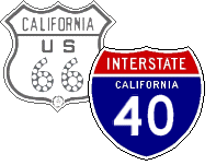
US 6
A significant portion of this route was signed with US 395, making one of the two a prime candidate to be eliminated under the policy of "one number equals one highway." US 395 was favored over US 6 since the former is one continuous highway that runs 3/4 the length of California; the latter enters California about half way up the state, north of Bishop.
US 40
I-80 replaced it along its entire run through California. Its number also duplicated I-40, necessitating its elimination per AASHTO Interstate Highway policy.
US 50
Although it remained signed until 1972 west of Sacramento, legislatively it was eliminated in 1964. All of its routing between San Francisco and Stockton was replaced by I-80, I-580, I-205 and I-5, making it unnecessary. The section between Stockton and Sacramento already coincided with SR-99 n�e US 99.
US 60
About 2/3 of its routing coincided with I-10. Route 60 ceased to be signed as a US highway in 1972 when the last section of the old highway through Indio was replaced by I-10. The remaining portion between Beaumont and Los Angeles became SR-60 as it could not retain the US 60 designation since the portion between Beaumont and the Arizona border had been eliminated.
US 66
Almost 3/4 of its routing had its functionality replaced by Interstate highways 210, 15 and 40. While only a few portions were directly replaced by Interstate highways, it appears the State could not justify keeping it as a state highway, especially between Barstow and Needles. This is evident by the way the last of the US 66 signs came down at almost exactly the same time the last part of I-40 was opened. Like US 60, a remaining portion received the state designation since the loss US designation along the Interstate highways left them as "orphans." Along with many other historical highway enthusiasts, I feel the SR-66 designation insults the highway as a whole with such a short section retaining the number.
US 70
Its whole routing in California was identical to I-10. It also was never signed alone in California. Why this highway even was extended into California is something of a mystery to me.
US 80
Like the case of US 66, much of its routing had its functionality replaced by I-8 and since its number duplicated I-80, it had to be eliminated per state and AASHTO policies. Interestingly, while it was legislatively Route 8, the non-freeway portions remained signed as US 80 with no trace of I-8 signage. It ceased to exist in California upon the completion of the last section of I-8 freeway in 1974.
US 91
Most of its routing was the same as I-15 from San Bernardino to the Nevada border. The portions that remained independent were signed as SR-91 in accordance with the State's apparent policy of not retaining "orphan" US highways.
US 99
A little less than half of its routing was replaced to the north by I-5 and to the south by I-10. This left several disjointed sections, the longest of which became SR-99 as a tribute. Like US 60 or US 80, it could not retain its US highway definition since the remaining sections were orphans as well.
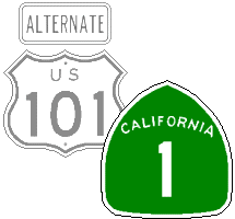
US 101
It was shortened because its routing between Los Angeles and the Mexican Border became I-5; it took until 1968 when the final portions of I-5 were completed for the shields to be taken down. Both US 101A and BYP-101 were replaced since the legislative route number 101 was already in use. Since the policy was to make the route number match the legislative number, they both took on state highway numbers.
US 299
While this route was extended by 43 miles, it was converted to a state highway in accordance with AASHO's policy of not retaining US highways that traversed just one state, plus it was a great candidate for the cool new green signs.
US 395
This route was not immediately affected by the 1964 renumbering, but ultimately the southern portion was replaced by I-15 around 1969-70. It is evident it happened at this time since legislatively Route 395 was routed to San Diego until 1970 while its successor, Route 15 ended in San Bernardino at I-10. In 1970 the legislative numbering showed that Route 395 ended where it does presently while Route 15 was made to end in San Diego. This also appears in practice where Route 395 post mile markers (not used until after 1964) can still be found on old sections in north San Diego Co. By contrast, US 80 had Route 8 post mile markers and US 99 north of Los Angeles was given Route 5 post mile markers.
US 399
Like US 299, the primary reason for renumbering this was AASHO's policy. Also being able to re-sign it with the preferred white on green highway markers certainly influenced its being renumbered.
US 466
About one-third of its California routing was replaced by I-15, which left it an "orphan" route like US 66 and US 91. However, since it appears California avoids higher state route numbers, it was assigned to Route 46 (a truncation of the number 466) and Route 58 (its old legislative number).
The years 1963-64 marked a major turning point in the evolution of highways in California. In this short span of time, the highway numbering and identification system transformed from a system with roots in the early part of the 20th Century to our modern familiar one. Many events had transpired to make the changes necessary, some within the control of the State with others mandated by federal policies. This was also a transformation that signified the changing of the guard from a nostalgic era represented by Route 66 to the modern era of efficiency. In the end all the changes that occurred to the US highway system in California bring to mind the famous quote General of the Army Douglas Macarthur said in his farewell address: "Old soldiers never die, they just fade away." Perhaps in a similar context one could say "Old highways never die - they just fade away."
1.) California Highways and Public Works
2.) For more information about the renumbering, see Daniel Faigin's California State Highway Routes Before 1964.
3.) Richard C. Moeur has reprinted policies relative to Interstate and US Highways.