 |
US 99 Photo Gallery:
|
Weldon and Gavin Canyons | Piru Gorge | Gorman
 |
Gavin Canyon (1949) The picture at left shows the newly completed US 99 expressway looking south toward Gavin Canyon and the San Fernando Valley. The southbound lanes, visible as the lighter concrete, were added with the expressway; the northbound lanes still had the original 1930 concrete and were modified for the expressway. This expressway still exists today, although the portion between the left edge of the picture to just beyond the parked car (which belonged to the photographer) was removed for the freeway. Unfortunately, the concrete was given an AC overlay in 1994 after two bridges on I-5 collapsed due to the Northridge earthquake. |
 Photograph courtesy of USGS. A larger photograph is available. (Caution: 110 Kb file size!) |
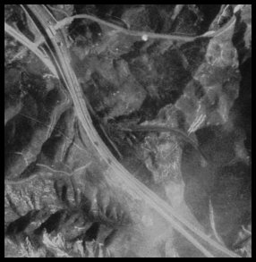
Violin Summit, 1994 This picture shows I-5 and the bypassed section of US 99 at the top of Five Mile grade at what is commonly called Violin Summit. While the roadbed of old 99 is visible from the northbound lanes of I-5, it is much clearer in this picture in the lower right as it forms a half crescent before going under the freeway. It reappears in the upper left as a wide divided road that is very drivable to this day. |
 |
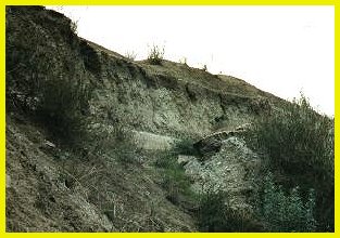 |
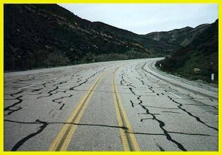
US 99 in the Piru Gorge The section of US 99 shown at left was widened in 1951 to four lanes divided from the original three lanes. The highway was built to modern freeway standards: the lanes are 12' wide, the median is 6' and the shoulders were defined to be wide enough to park a vehicle. This standard is still applied to other limited access highways in California - the US 101 freeway in northern California is an example. The photograph at above right shows the old alignment from 1932 buried under the 1951 alignment. While the widening of 1949 - 1951 followed the older alignment almost exactly, it buried it in many places to make gentler, expressway standard grades. The picture at right shows the US 99 expressway looking south toward the Piru Gorge. Pyramid Rock is in the center of the picture, although it is occluded by the hills, which also hide the series of bridges over which 99 went. Three Mile Grade is visible in the background; Castaic is located at the distant background. |
|
 Photograph courtesy of Caltrans |
 |
Piru Creek Bridges (1932, 1951) The picture at left was taken shortly after the bridge was widened (in 1951); the bridge is now under Pyramid Lake and shows both the 1932 wood guard railing and 1951 wood guard rail. The bridge at right is the last freestanding bridge on US 99 between Santa Clarita and Bakersfield. The side closest to the camera was built in 1932 and was three lanes wide; it had whitewashed wood guardrails typical of the period; the other side has the corrugated metal metal guardrail visible in the picture at left. |
|
 Photograph courtesy of Caltrans |
 Photograph courtesy of Caltrans |
US 99 through Gorman: 1958 Gorman is a very historical location along the Ridge Route. It has been a stop for travelers since the middle of the 19th Century, predating automobiles. It became a popular stop along the old Ridge Route and continues to be a destination to this day. Originally, US 99 went over the old Ridge Route, then was widened in 1933 to three lanes, which are still visible to this day. This alignment is visible in the pictures above - it is the narrow concrete that splits from and rejoins the wider expressway. The expressway bypass was completed in 1951 and is unusual since it follows a straighter alignment that the road it supplanted (most expressway bypasses looped to the outside of the town). The expressway is now under I-5. |
|
![]()
 |
Go south to Los Angeles. Continue north to the Tejon Pass and Grapevine Return to the US 99 Page. |

Go to the Historic California US Highways Main Page
![]()
http://www.gbcnet.com/ushighways/US99/99pics_f.html
