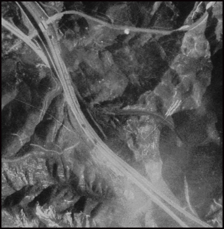
Courtesy US Geological Survey
The above picture shows the last section of US 99 to be replaced by I-5,
which happened on August 24, 1970.
I-5 is the series of two thick lines that converge in the lower right hand corner and go
diagonally to the
upper left; the interchange is Templin Highway. The visible superseded section of US 99
is mostly just the
grade, but there is a paved portion visible in the upper left, disappearing under I-5. It
reappears on the right
hand side and forms a semi circle before going back under the northbound lanes of I-5 in
the lower right. Half
the curve is visible from the northbound lanes of I-5, but it takes the aerial picture to
see how it all fits. This
picture also shows the huge improvement in grade and alignment the freeway has over the
old road.
Return to the